Saturday, 7th July
Back in Christmas 2016, we got a lovely gift from our little nephew Eban – a RIB ride excursion to the Skerries, off the North coast of Anglesey, and back down to South Stack. Unfortunately, due to us living in London and bad weather when we were actually up in Wales, the trip was somewhat delayed. Thankfully, we planned a little break away to Wales for a long weekend, and the weather looked incredible – so, a year and a half after getting the gift – we were all booked in to go on the RIB ride.
Our trip started from the Holyhead marina. We were greeted by our skipper called Olly and after we were shown around the boat and the various health and safety tips, we were off – blasting through the waters, North bound towards Church Bay & Carmel Head, before venturing out to open sea, and The Skerries.
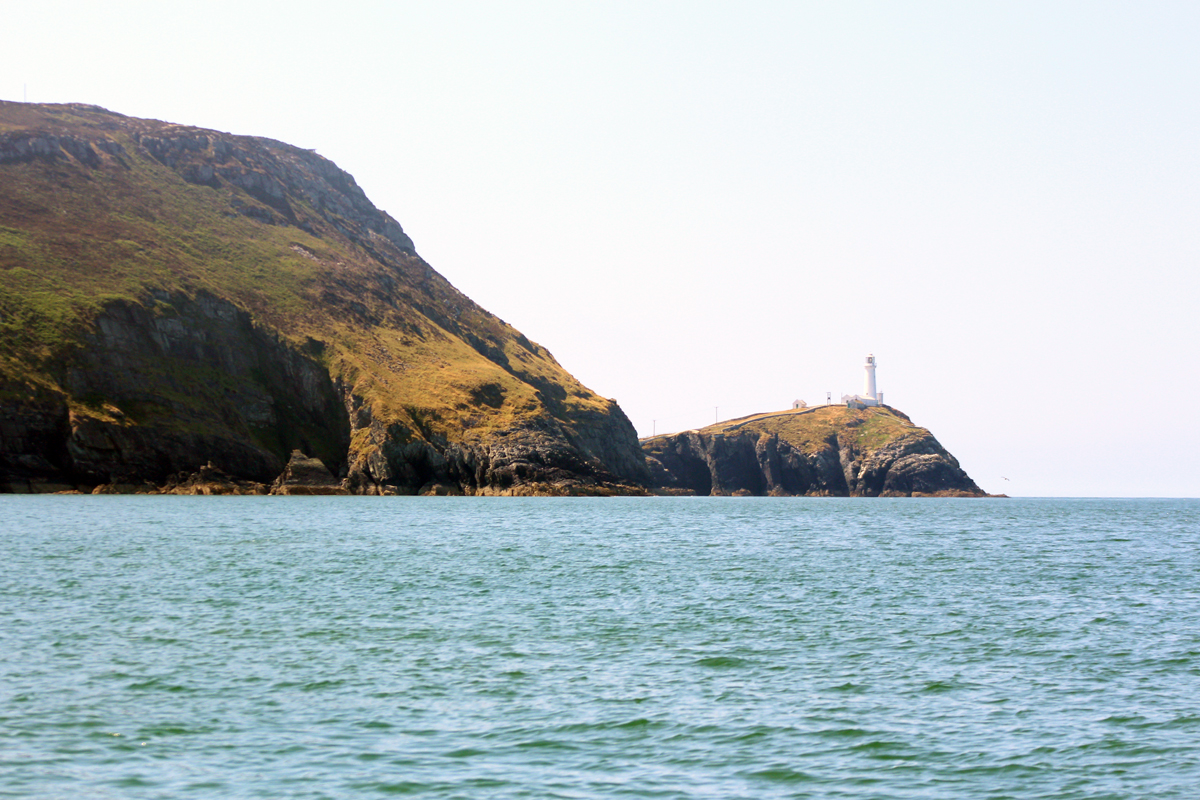
The Skerries, [are] a unique group of rocky islands with Trinity House lighthouse, built in 1716, on the highest point. In Welsh the islands are known as Ynysoedd y Moelrhoniaid, which means ‘the islands of the bald-headed grey seals’.
This Important Bird Area and SSSI has a very large Arctic Tern population (over 2,000 pairs), Common Terns and a smaller Roseate Tern population; it is also home to Puffins and Kittiwakes. This uninhabited group of islands has a distinctive cliff and maritime grassland environment.

Trinity House lighthouse

Trinity House lighthouse & the Terns
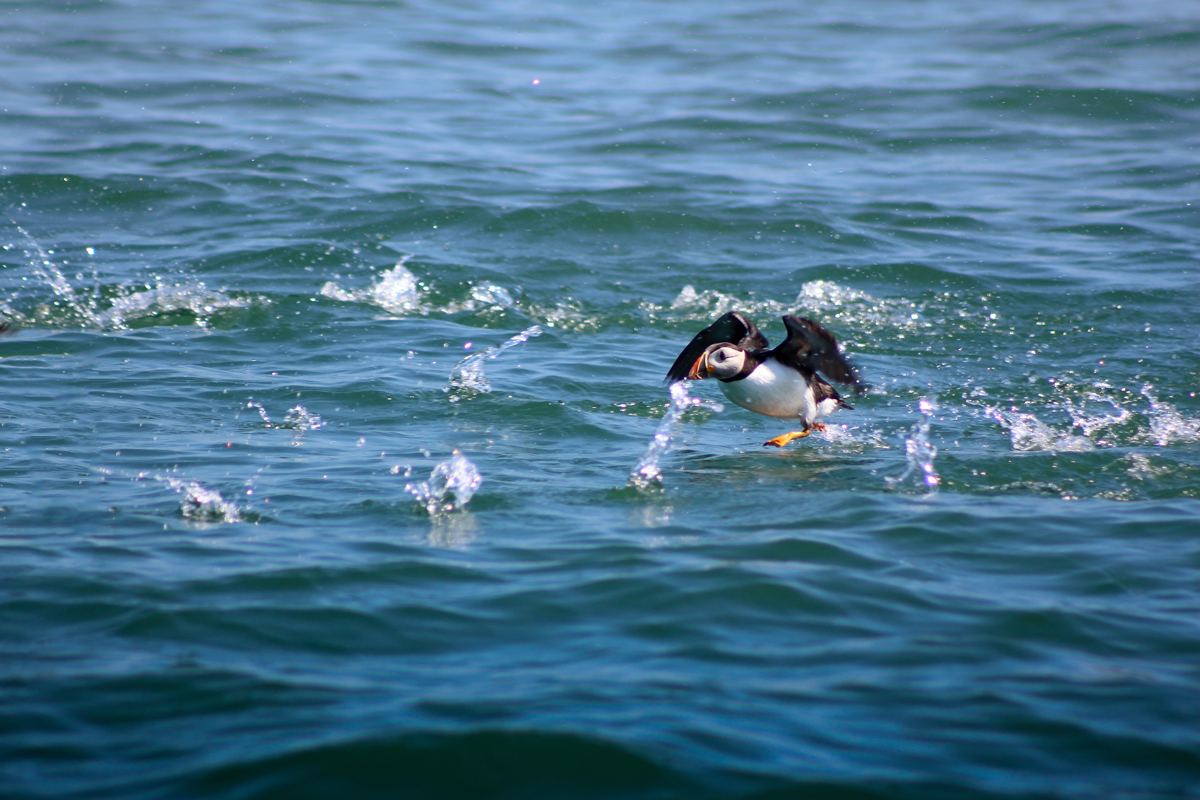
The first thing we noticed was just how many Terns there are out here, incredible! They kept swooping in and over the boat as we made our way towards Trinity House lighthouse to anchor and watch the wildlife around us. According to the internet, there’s over 2,000 pairs on the island. Just over the brow of the crags, we could also see a handful of Puffins just chilling and coming in to land from being out feeding.

Artic Tern (left) and Common Terns
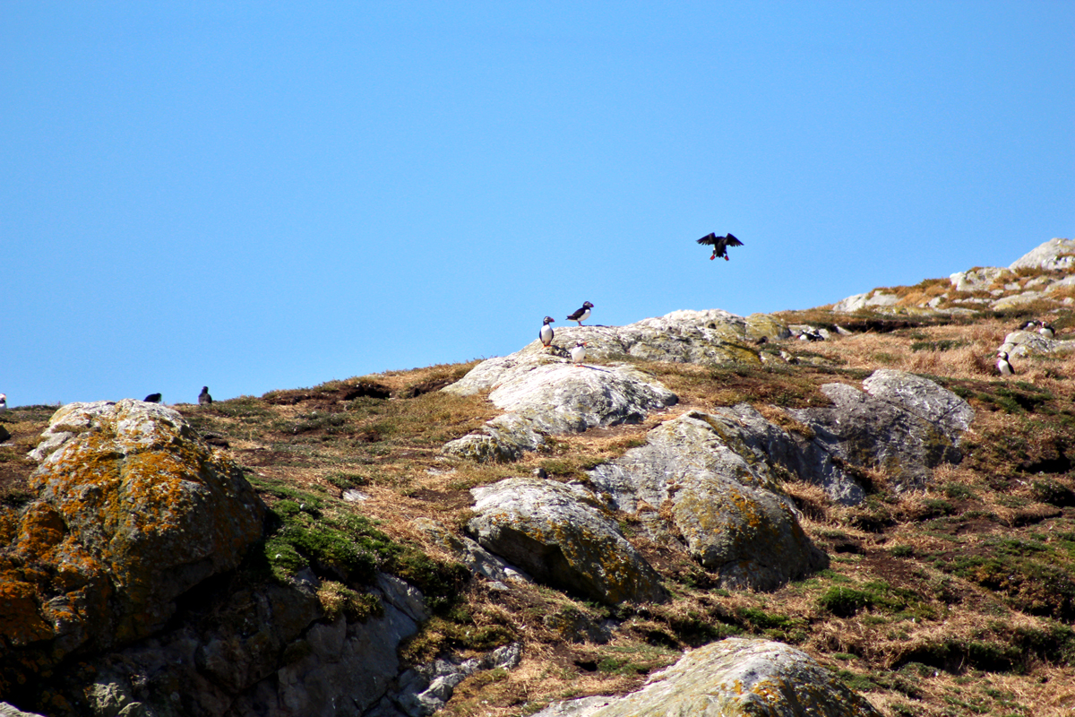
A Puffin coming in to land
We spent about 15 mins anchored to a buoy just underneath the lighthouse, surrounded by crystal clear seas. All around us, chilling on the rocks, swimming casually and making the most amazing sounds were a whole lot of grey seals. So much wildlife, and never had we seen Wales to sunny!

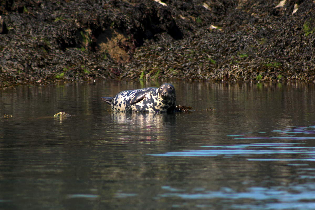
A cheeky Seal
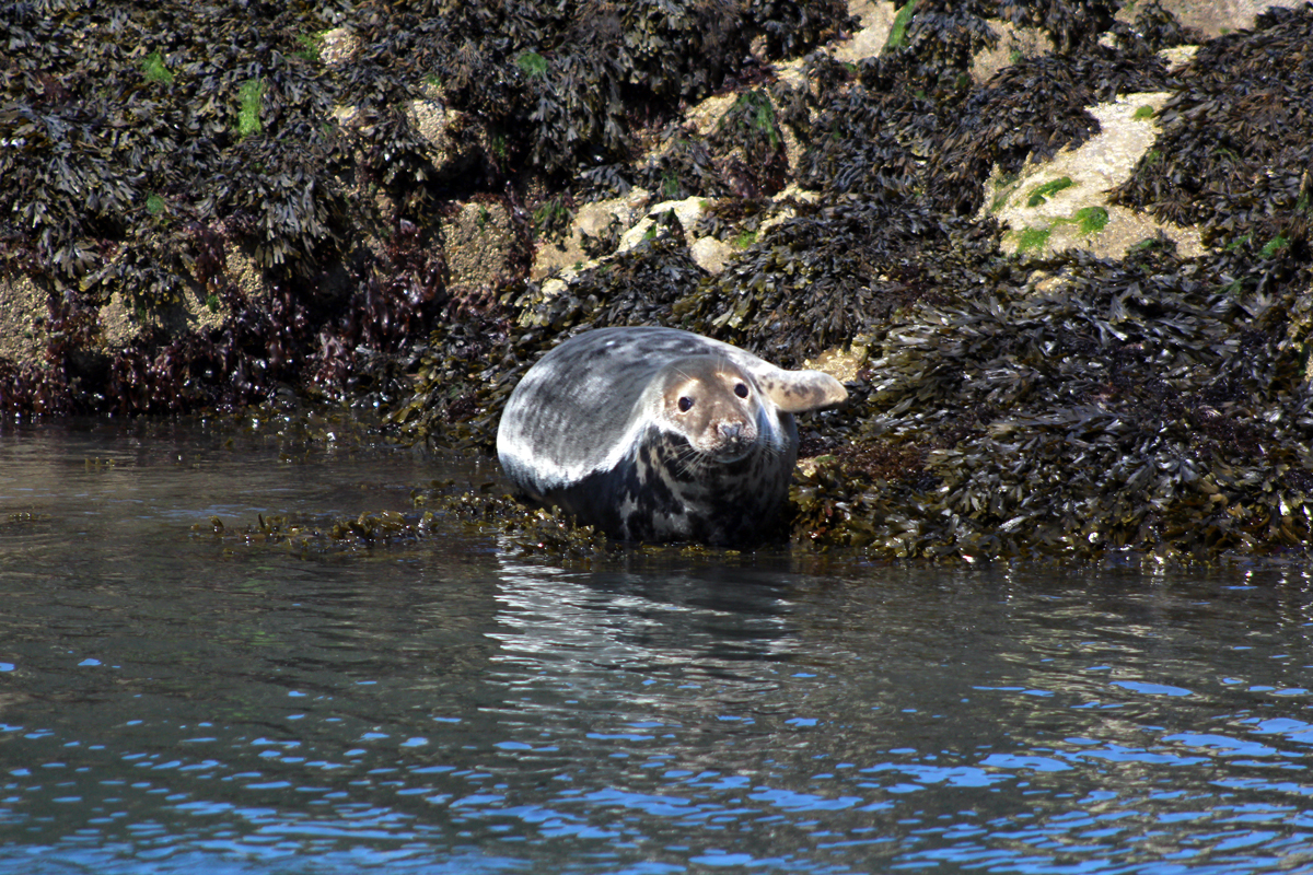
Look at that face!
As the RIB Ride website says; “We then begin the adventurous nine-mile open-sea crossing to the island of North Stack. Here we explore the caves and the dramatic 100m high sea cliffs of Gogarth Bay to reach the lighthouse on the island of South Stack. We will watch the Chough, Guillemot, Peregrine, Puffin and Razorbill at the RSPB South Stack Cliffs nature reserve before we return.” – which is exactly what we did.
Along the way, we spotted a circus of Puffins out at sea – Olly slowed down for us, so we could take some great snaps.
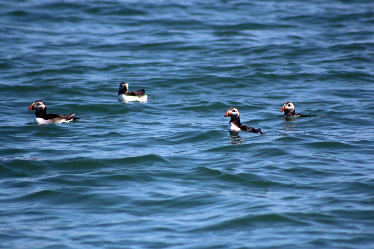
A circus of Puffins!
Startled Puffin
Being the sharped-eyed skipper that he was, Olly also spotted a few Porpoises out at sea. Down over underneath South Stack we were met by the massive cliffs, and a whole lot of guillemot and razorbills swimming casually in the sea.

A Porpoise
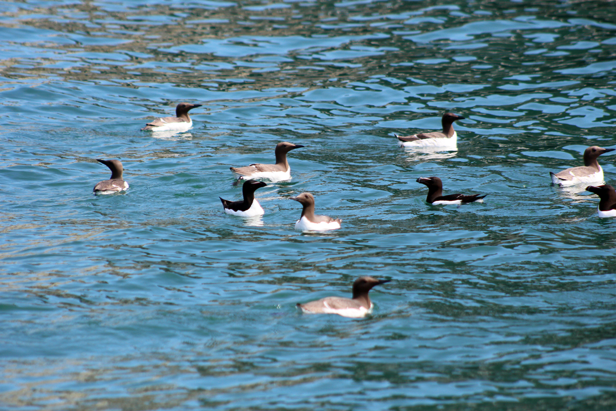
Guillemot (brownish) and Razorbill (black)
From here we dipped in and out of the sea caves, all while Olly was giving us the historical information about the lighthouse, and how they used to load goods onto the island before the steps were constructed etc – all super interesting. Then, we blasted over to Gogarth, a very popular bit of rock, where we could see climbers starting their climb up to the top.
Looking back towards South Stack
And that was it… we cruised back on over to the Holyhead marina – what a fantastic start to our day!
After a quick stop in sunny Rhosneigr for lunch, we cruised over to Tesco’s to pick what would be our dinner – as tonight, we were camping in the mountains.
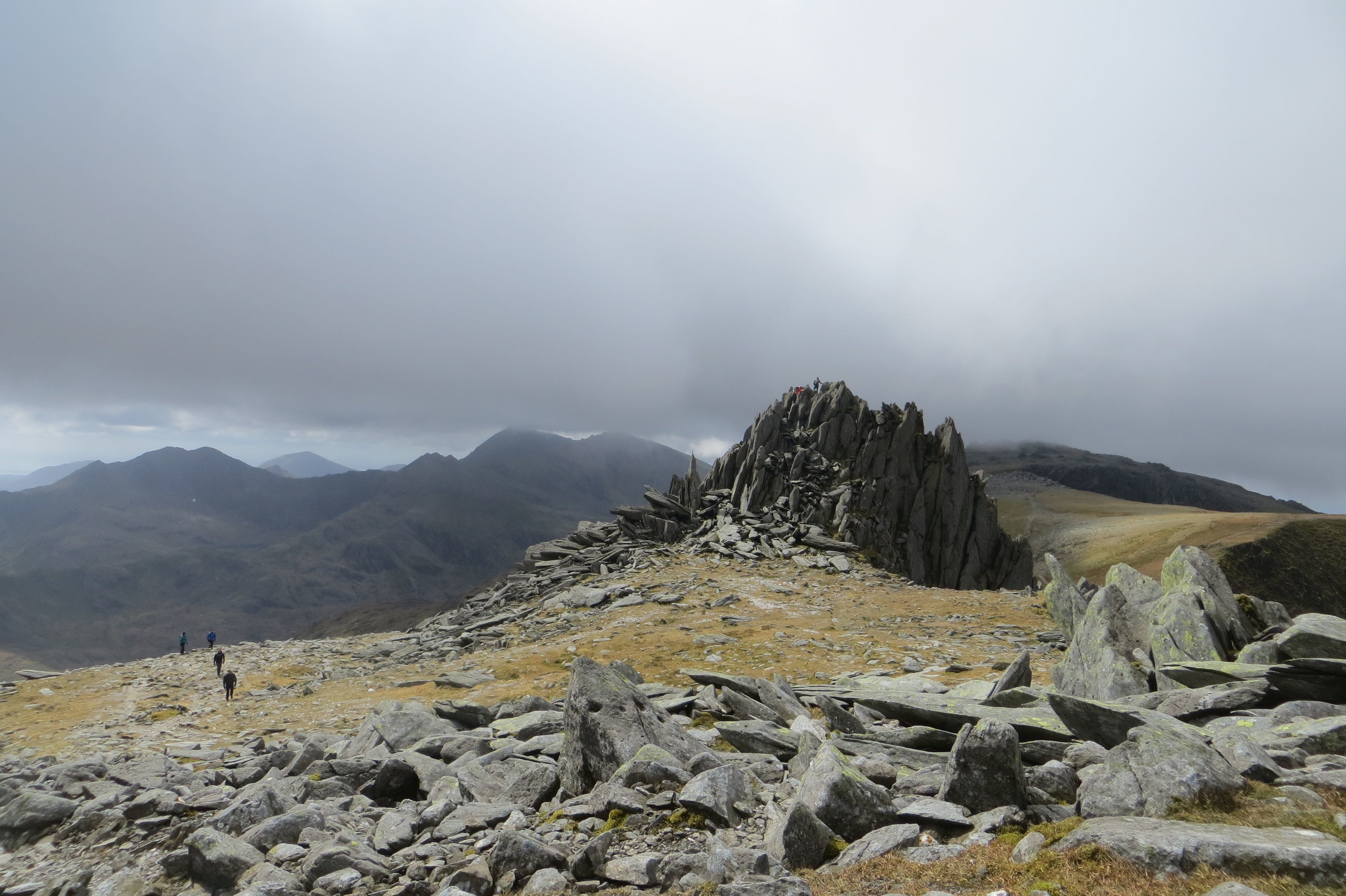
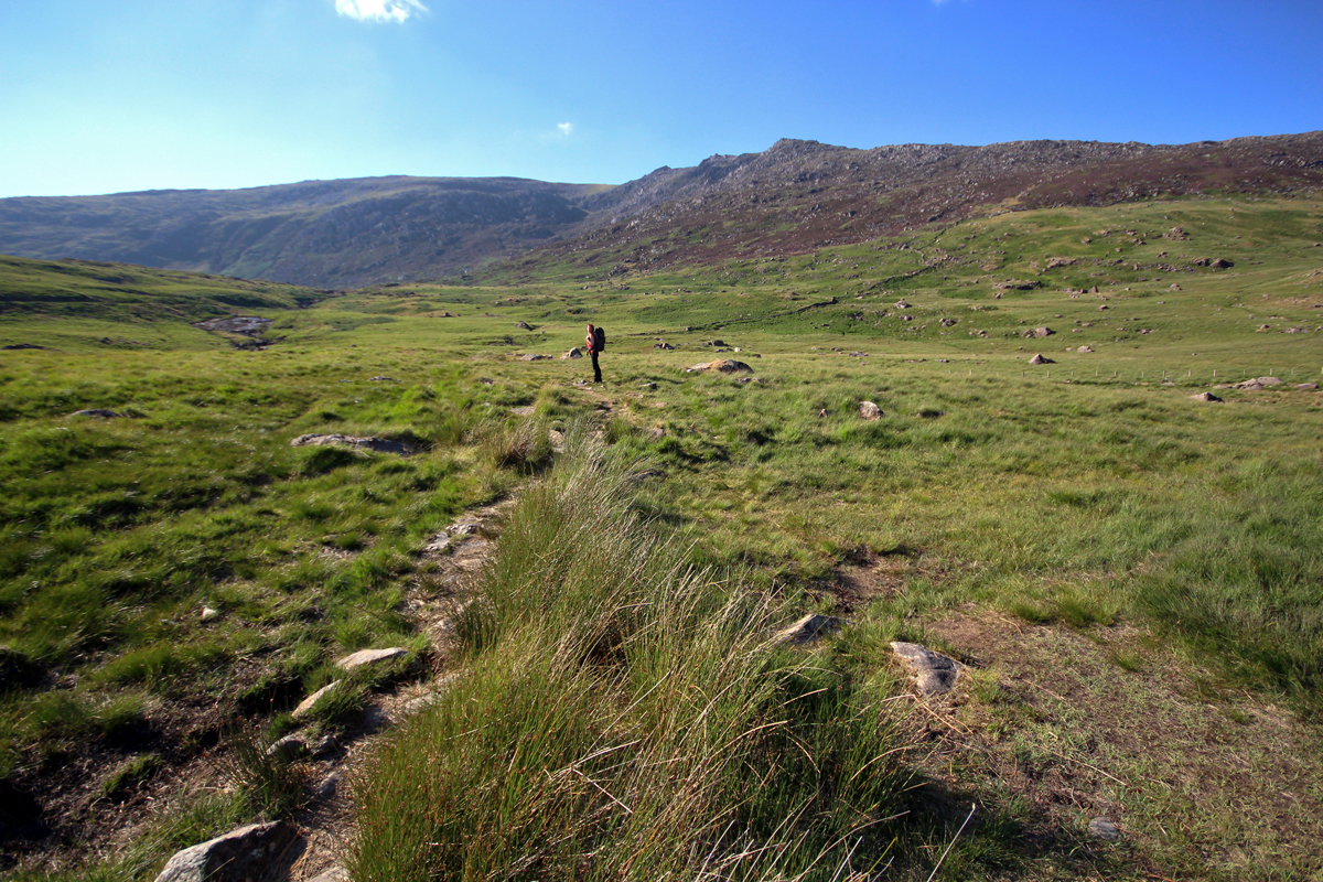
We packed, and got dropped off at Pen y Gwryd by Dad, our destination was Llyn Caseg-fraith, inbetween Glyder Fach and Foel Goch, overlooking the mighty Tryfan in the Glyderau.
Gina in the Glyderau
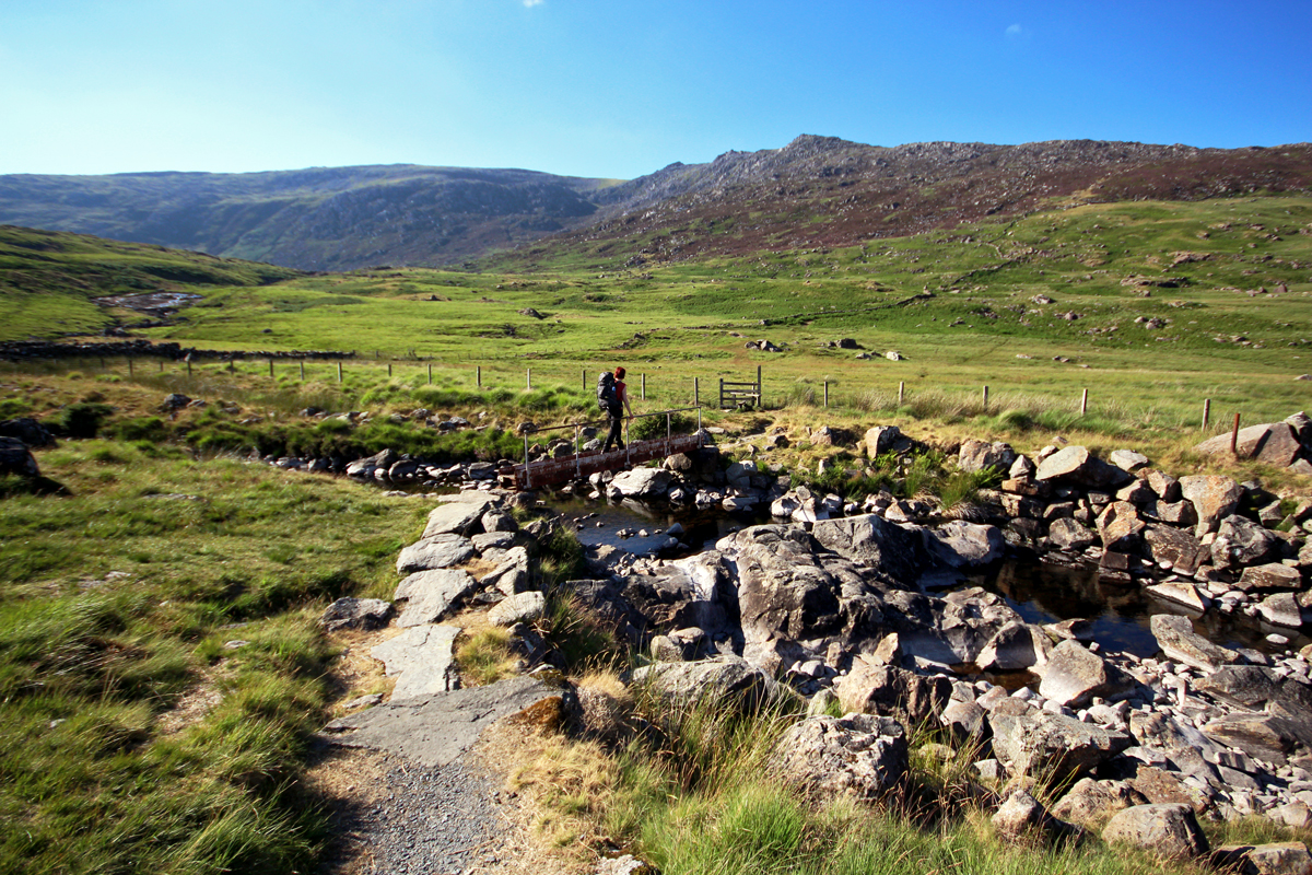
Gina crossing Nant Y Gwryd
We headed on up, and had nothing but good times – the sun was blasting, the evening light was starting to fall, and it was looking lovely! We knew once we got to the top, we were in for a great night camping.
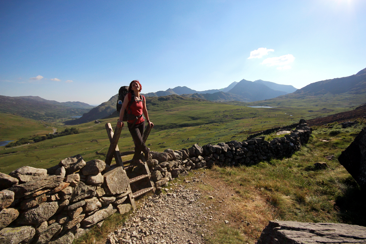
Gina on the gamfa
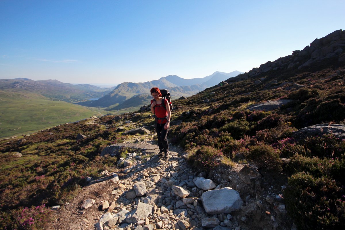
Fantastic evening light
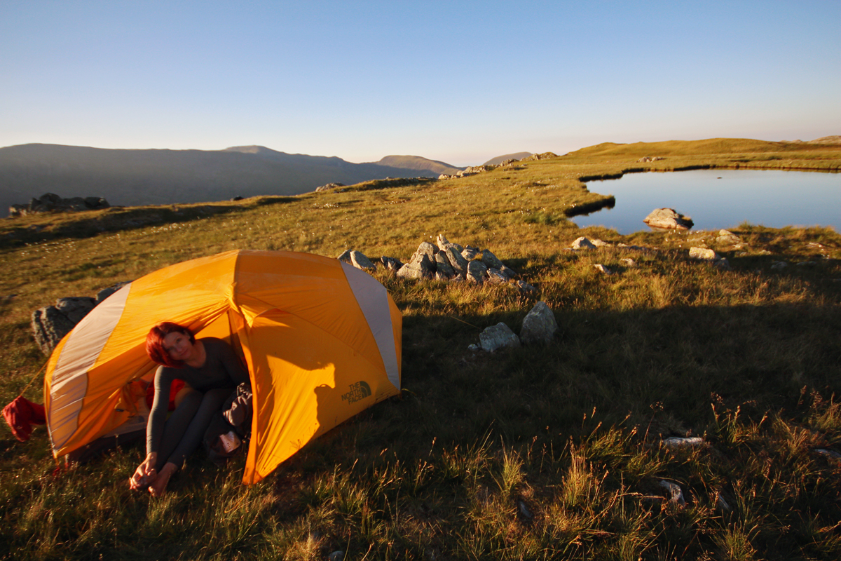
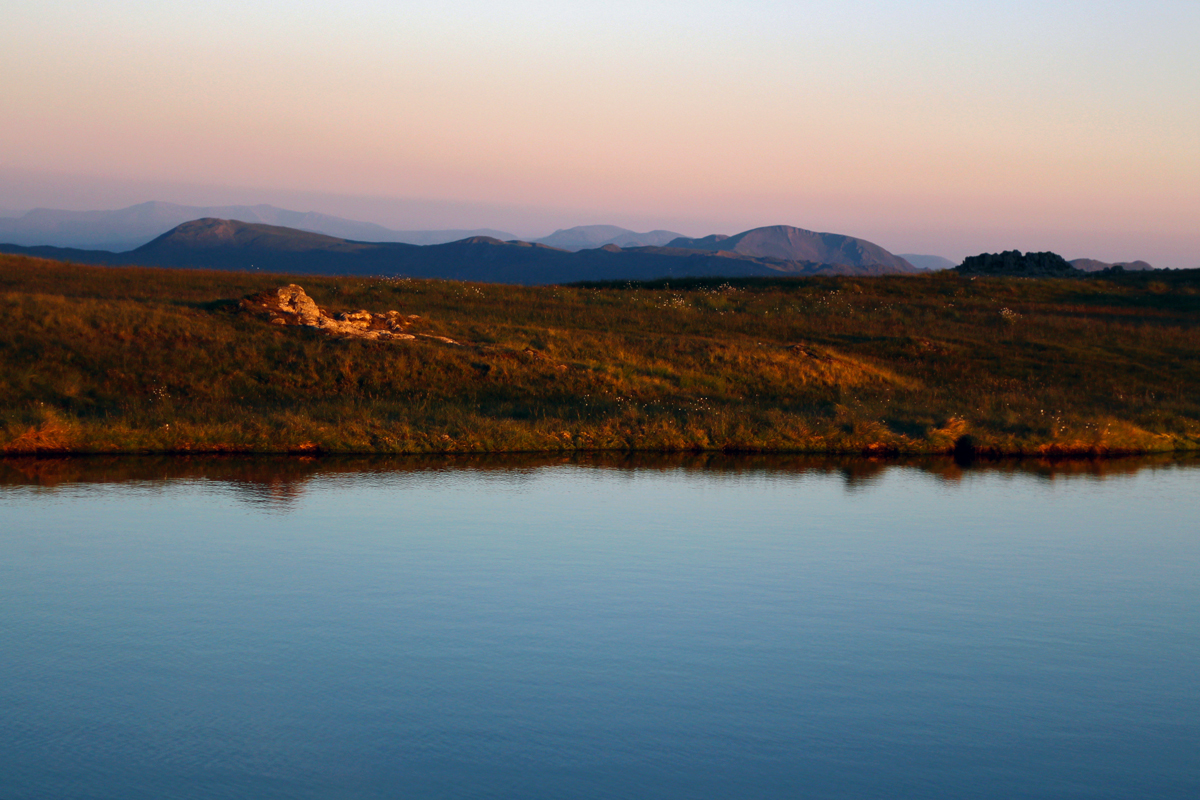
We arrived at Llyn Caseg-fraith, a small lake that’s nicely located above Tryfan just as the sun had started entering its golden hour. Much to our surprise, we weren’t the only ones up there wild camping. There was another tent on the other side of the lake, and soon another guy arrived, hiding his tent behind the rocks nearby. Everyone minded their own business though, and it was very quiet all around. We pitched the tent without a bother – and began our plans of chilling to-the-max.

Our tent, overlooking Tryfan
Gina about to chill with a book

Iest, chillin’
And yeah, this was the scene pretty much for the whole evening. We ate our picnic, did some time-lapse photography with my iPhone, Gina read her book and hit the sack. It was super pleasant up there, not a whisper of wind – awesome.
The evening colours
Sunday, 8th July
We awoke to another beautiful, cloudless sky morning. We had a leisurely breakfast, chilled some more, before packing up the tent and sleeping stuff. The goal for this morning was to head up Glyder Fach, over to Glyder Fawr, and down into Nant Peris the other side of the mountains – where Dad would then pick us up in time for lunch.
Everything on the way up to the Glyderau went super well, we were cruising – enjoying the views.

Morning Gins!

Looking back at Llyn Caseg-fraith
Unfortunately, on the way down the slippery scree of Glyder Fawr, my knee (which I’d been having physiotherapy for for the past 3 weeks) totally gave way. I went down and yep, this was agony. It took me about 2 hours to get down, whereas it should have taken about 30mins – this wasn’t good – as Dad was down in the valley waiting for us. Dad suspected that something might have been up, but he continued to wait until Gina went ahead and met up with him, while I took my time getting down safely. Damn knee!
We got back home, I iced my knee for a few hours, and went over to meet the newest addition to the family; little baby Erain. Then headed over to Pant Du for some lunch and apple juice – which was great! We then decided to take a trip to our fave beach, Llanddwyn for the evening, to chill in the sea (legs only) whilst the sun gently went down.
All in all – a pretty awesome trip back home for the bank holiday!